


At 8:00 a.m. on a Tuesday, Li Wei, a 28-year-old graphic designer in Beijing, taps her phone to hail a cab. The app shows a taxi three minutes away, rolling through traffic. When it arrives, it pulls up almost exactly where she stands—not five meters off. A few hours later, she orders lunch from her favorite noodle shop. As the delivery rider weaves through a warren of hutongs, the map pin moves with the rider’s every turn. After work, she unlocks a shared bike. When she parks it inside a designated green zone, the app confirms she’s parked correctly.
None of these actions feel special. They’re just part of China’s urban rhythm. But every one of them relies on a technology invisible to nearly everyone who uses it: the BeiDou Navigation Satellite System (BDS). You’ve probably heard of BeiDou as China’s answer to GPS. But what does it actually mean for ordinary people’s lives? Let’s walk through a typical day and see how satellite signals are quietly rewriting the routines of millions of Chinese.

What Exactly Is the BeiDou System?
Before we get to the daily details, a very quick background. BeiDou is China’s global navigation satellite system. It began with a regional setup in 2000 and has grown into a full network of over 30 satellites. Since 2020, it provides global coverage. It works similarly to GPS: satellites transmit signals, devices calculate their positions. What’s different is that Chinese phone manufacturers and app developers have integrated both GPS and BeiDou compatibility. In practice, your phone chooses whichever signal gives a more reliable fix—sometimes both. To the user, nothing seems different: the map just works.
So when you see a friend wince at a bad location in a crowded city, it’s rarely because of the system. It’s the environment. With BeiDou, though, a remedy is close.
A Day Made Easier by BeiDou
Catch a Cab, Without Playing Guess-Where-You-Are
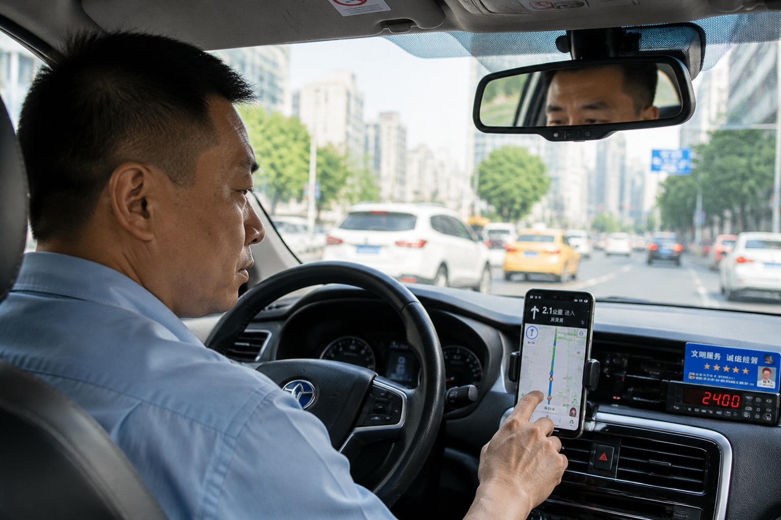
Ride-hailing is a daily ritual for many urban Chinese. In the pre-Beidou era, the “jumping car” was a common annoyance: the driver’s marker would leap around on the map, making pickups slow and frustrating. Drivers would cruise past your block, stop a hundred meters away, or call to ask where you were. Today, most ride-hailing apps have packed in dual-band GNSS (that includes BeiDou) to deliver lane-level positioning. For the user, this means the car tracks smoothly toward you, and platform algorithms know exactly which side of the road you’re on. Less time checking your phone, more time enjoying your commute—if a taxi ride in bumper-to-bumper traffic can be enjoyable.
Order Food, and Watch Your Map Ping with Precision
China’s food delivery platforms are a marvel of urban logistics. What makes them so efficient? Real-time location intelligence. Each courier’s phone and wearable device carries positioning data that’s shared with the platform’s route optimizer. With BeiDou’s high accuracy, dispatch centers can assign orders to the rider who is truly closest, suggest shortcuts through narrow lanes, and show customers a live map with the rider’s progress. That isn’t just for curiosity; it builds trust. You know exactly when to go downstairs and meet your delivery. And if a rider takes an unexpected turn, the system may even notify you that the order might be delayed.
Grab a Shared Bike, and Keep the Sidewalk Clear
Shared bike companies like Meituan and HelloGo have turned electronic fences into reality. An electronic fence is a geofenced area where riders must return their bikes. Bikes are equipped with a positioning module that talks to BeiDou. If you leave your bike within the invisible boundary, you’re good. If not, the system may charge you a penalty or simply lock the bike. Because BeiDou is accurate to near a meter, the curb boundary is clear and enforceable. As a result, chaotic piles of bikes that used to litter sidewalks are now mostly gone—at least until someone decides the painted green line isn’t worth the fee.

Catch the Bus, with Arrival Times You Can Trust
If you’ve ever waited at a bus stop in a Chinese city, you’ve probably seen the electronic sign on the pole: “Next bus: 4 minutes.” That information is made possible by bus-mounted satellites. The bus’s precise position is transmitted to a control center, which calculates expected arrival times using traffic data. With BeiDou, this accuracy has improved in dense areas where tall buildings can block signals. Passengers using transit apps can also see buses moving along the route, and plan transfers with confidence. This small convenience adds up to a big difference in daily congestion.
Why Did China Build Its Own Satellite System?
The short answer: autonomy. Building a satellite navigation system is expensive and takes years, but China decided it was necessary. With a system as critical as positioning, relying solely on another country’s GPS isn’t comfortable for a world power with global ambitions. And it’s not just about pride—real-world dependability matters. If a GPS service were disrupted, Chinese railways, power grids, and maritime fleets could be affected. Having BeiDou ensures a backup that’s always on.
There’s also an advantage many forget: BeiDou is a global public good. Farmers in Southeast Asia use it to map fields; search-and-rescue teams in remote areas use its unique short-message feature, which allows text messages even without cellular networks. That’s a game-changer in disaster zones.
The Road Ahead: BeiDou’s Next Act
China’s next generation of self-driving cars will lean heavily on BeiDou. Already, autonomous delivery robots and drones use its signals. Satellite navigation in the future will be integrated with 5G and AI, and BeiDou will be part of that fabric. The challenge is to make positioning seamless in indoor and underground environments—but that’s where other sensors step in.
For ordinary people, the future will probably look like today—just more convenient. You won’t get an alert saying “this service is powered by BeiDou.” You’ll simply notice that your package arrives faster, your ride is smoother, and the city feels more organized.
Li Wei’s day ends with her walking into a metro station, glancing at the screen for the next train time. She taps her transit card, nods to the security guard, and is gone. She has no idea that a network of Chinese satellites has been helping her all day. And in a way, that’s the greatest success story: the technology is so seamless that the people who benefit from it can simply forget it exists.
Start the discussion at forum.chinacomes.com