

Introduction
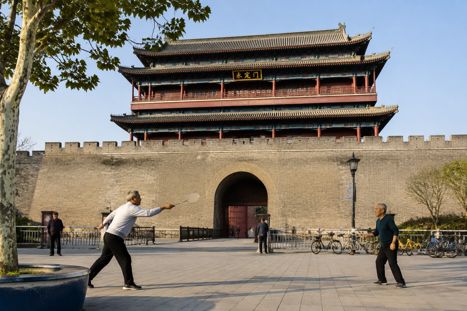
On a crisp autumn morning, a group of retirees play badminton under the watchful eye of a 16-meter-tall gatehouse in southern Beijing. This is Yongdingmen, the southern terminus of the Beijing Central Axis. Few of the players think much about the axis—it is simply the line their grandparents walked, and their grandparents before that. But this invisible line, running 7.8 kilometers from the Drum Tower in the north to Yongdingmen Gate in the south, has just been added to the UNESCO World Heritage List. And it is redefining how the world understands urban China.
What Exactly Is the Beijing Central Axis?
The Central Axis is not a single building or a road. It is a planning concept first laid out in the Yuan Dynasty (1271–1368) and perfected over seven centuries. The line runs through the exact center of Beijing’s old city, and along it sit some of China’s most famous structures: the Drum and Bell Towers, Jingshan Park, the Forbidden City, Tiananmen, the Zhengyangmen Gate, the Temple of Heaven, and the Altar of Agriculture. Together, they form a linear open-air museum of Chinese imperial architecture and urban design.
The axis was not just about aesthetics. It embodied the ancient Chinese belief that the emperor should sit at the center of a world ordered around him. By aligning the emperor’s residence with the cardinal directions and positioning key altars to the left and right, the city became a kind of cosmic diagram made in brick and wood. In 2024, UNESCO recognized this system as “an exceptional example of a spatial ordering that conveys the philosophy of a Chinese capital city.”
A Walk Through Seven Centuries
North End: Drum and Bell Towers
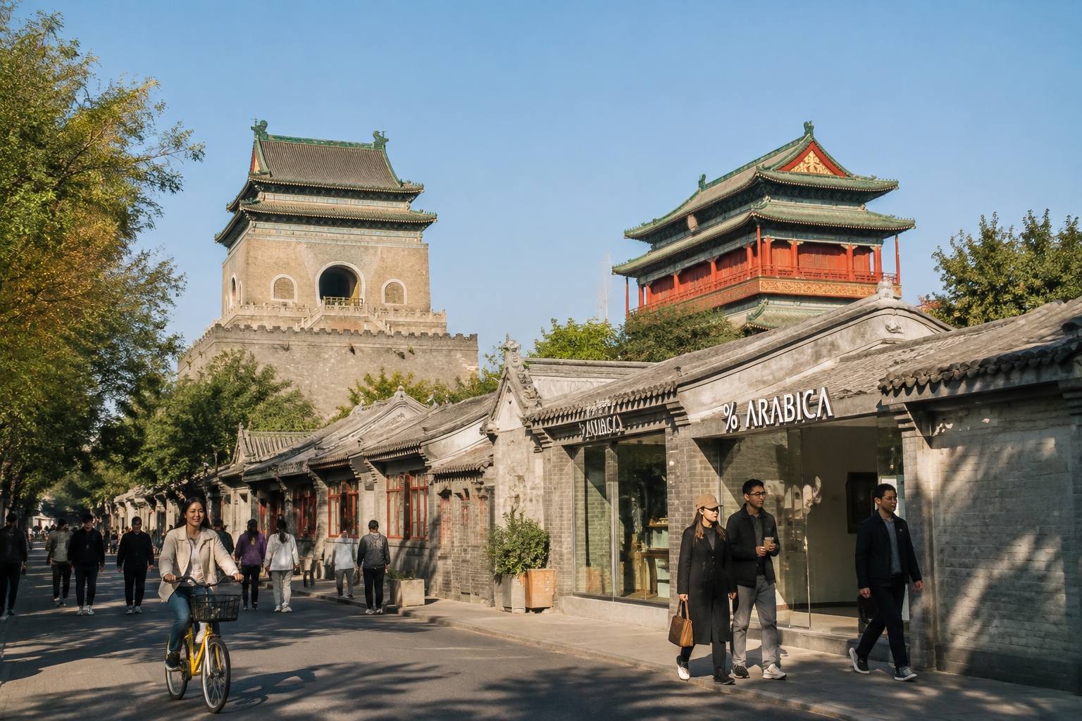
Start at the Drum Tower in the north, built in 1272 and rebuilt in 1420. From its platform, you can see the gray-tiled rooftops of the old hutong neighborhoods spreading out like ripples. Walk south, and you cross Wanning Bridge—the oldest existing bridge on the axis—then follow the curve of the lake that once served as the imperial granary. The Bell Tower, a little farther on, was used to tell time for the entire city until 1924. Nowadays, a local group occasionally performs traditional drum beats atop the Drum Tower, and the sound mixes with bicycle bells and distant traffic.
The Imperial Core: Jingshan and the Forbidden City
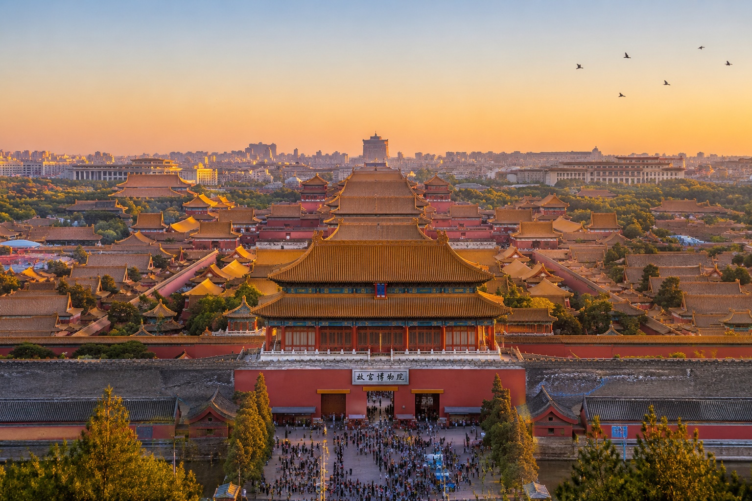
Continue south, and you reach Jingshan, a 40-meter-high artificial hill made from earth dredged from the Forbidden City moat. Climbing to the top, you earn one of Beijing’s best views: the golden roofs of the Forbidden City glinting in the morning light, and the axis stretching north to the Drum Tower and south to the Zhengyangmen Gate. Below, the Forbidden City itself is more than a palace complex—it is the physical heartbeat of the axis. Hundreds of years ago, emperors used this precise north-south alignment to symbolize their divine mandate. Today, tourists from every continent stream through its gates, following the same line that emperors once walked.
South: Altars and Gates
Farther south, the axis passes through Tiananmen and the Zhengyangmen Gate, once the main entrance to the imperial city. The final stretch is quieter. Here you find the Temple of Heaven and the Altar of Agriculture, two sites that balanced the emperor’s reliance on heaven and earth. The Temple of Heaven is surrounded by a park that locals treat as a vast living room: at dawn, dancers, singers, and tai chi practitioners fill the cypress groves. The Altar of Agriculture, less visited, now hosts traditional farming demonstrations for schoolchildren. The axis does not end so much as fade into the modern city, but its southern marker, Yongdingmen, was reconstructed in 2005 and now anchors a lively public square.
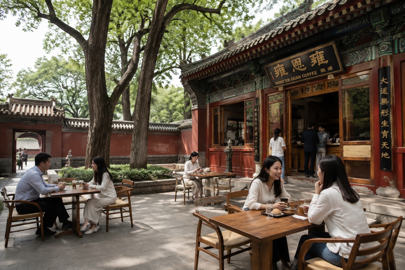
Not all the buildings along the axis are superstars. A small building called the Hong’en Guan Taoist Temple, tucked behind the Drum Tower, now serves as a coffee shop and cultural center. It is precisely these lesser-known spots that make walking the axis rewarding.
Why UNESCO Took Note
On July 27, 2024, UNESCO added the Beijing Central Axis to its World Heritage List. The application process took 12 years and involved rigorous documentation and conservation. The axis was evaluated not only for its architecture but for its continued use as a living urban space. In a city that sometimes seems to tear itself down to rebuild, the presence of a 700-year-old planning line that still shapes new developments is rare.
The heritage designation brings practical changes. Buffer zones limit new construction heights. Restoration projects have cleaned facades and overhauled infrastructure. But it also protects something intangible: the relationship between Beijingers and their city’s skeleton. That relationship is visible every morning.
How Ordinary People Use the Axis Every Day
The axis is not a museum behind a ticket gate. It is woven into daily life. In the mornings, Jingshan Park’s hill is crowded with pensioners practicing tai chi, and the top of the hill offers a postcard view of the Forbidden City and the Drum Tower. The lakeside paths near Shichahai are used by joggers and coffee drinkers long into the evening. The Temple of Heaven park, once a venue for imperial sacrifice, is now famous for its morning gaggle of singers, dancers, and card players.
Younger Beijingers have also adopted the axis. Walking tours that connect the area’s 33 historic sites are a weekend favorite for urban explorers. Some companies offer mapping workshops where participants photograph the axis and compile their own digital archive. On lucky weekends, you can join a guided tour that ends with a climb onto the Bell Tower platform, where a new café serves coffee with a side of history.
The axis is also a catalyst for neighborhood renewal. Along the northern stretch, old hutong houses have been retrofitted with modern plumbing and heating, while maintaining courtyard layouts. Small shops selling traditional crafts have reopened in spaces that once had no electricity. The integration of ancient architecture with contemporary design is not without friction, but it is a distinctly Chinese experiment in how to carry a seven-century-old concept into the next century.
A Personal Detour: Coffee and Temples
Perhaps the best way to feel the axis’s living pulse is to do something ordinary. I once spent an afternoon sitting in the courtyard of Hong’en Guan, sipping a flat white and watching a steady stream of visitors—young couples taking photos, elderly monks in grey robes, school kids on a field trip. The temple’s red walls are centuries old, but the coffee is freshly ground. That contrast is not jarring; it is the natural texture of Beijing today.
Conclusion: More Than a Line
The Beijing Central Axis is often described as a symbol of Chinese civilization. But it is more than a symbol. It is a working part of the city, a pedestrian route, a place of worship, a market, and a backdrop for daily life. Walking it is to literally step from the Yuan Dynasty into the digital age, with each gate and tower marking a century of change. The line is not in the past; it is under your feet.
For those who have yet to visit, the axis offers a way of understanding China that no book can fully convey. Because when you stand at the Drum Tower and look south, you are not looking at a collection of monuments. You are looking at a city that has spent 700 years learning how to arrange itself—and that knowledge is still working.
Start the discussion at forum.chinacomes.com