

The two minutes when the sea disappears
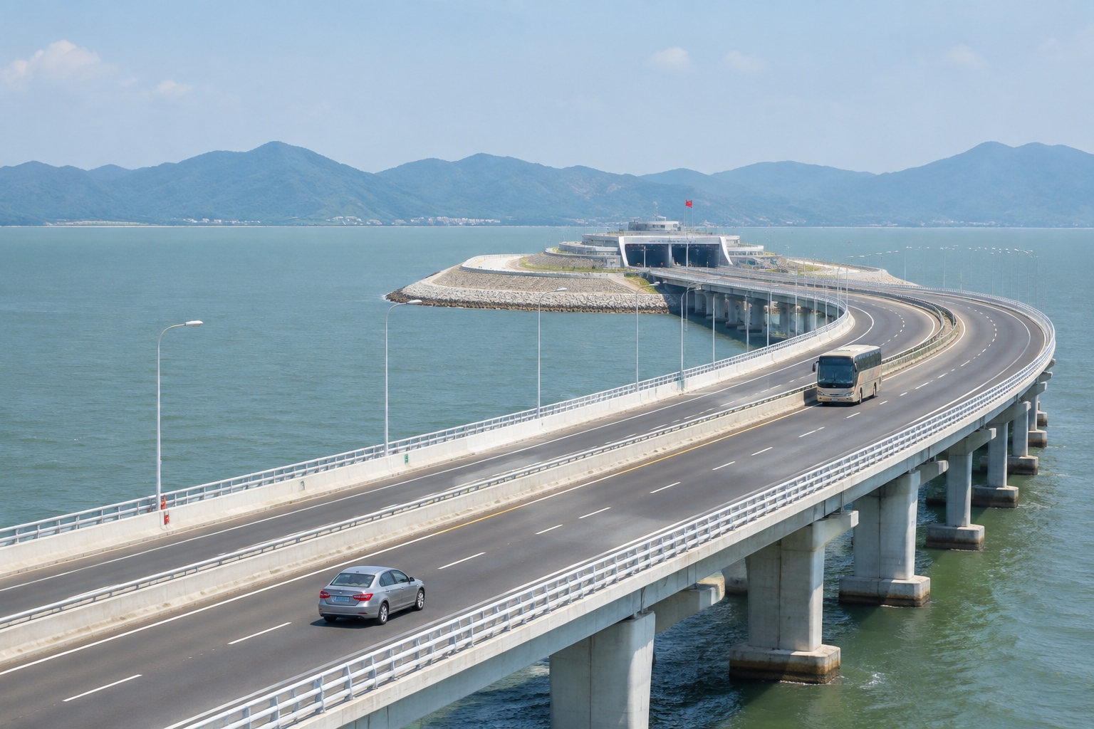
Drive west out of the Hong Kong-Zhuhai-Macao Bridge port, past the last row of customs booths, and for about twenty minutes the bridge behaves exactly like a bridge. It runs straight across the Pearl River Estuary, water on both sides, the hills of Lantau Island shrinking in the mirror. Then the road dips toward an artificial island, slides into a gap in the concrete, and the sea is gone.
For the next 6.7 kilometers you are driving on the seabed. Container ships pass above your roof. There is no horizon, just tunnel lighting and the low hum of ventilation fans. Then the road rises back into daylight, and you are in Zhuhai, on the Chinese mainland, with Macao’s towers visible to the south.
That is the first thing to understand about the Hong Kong-Zhuhai-Macao Bridge, usually shortened to HZMB: it is not a bridge you can see from end to end. It is a 55-kilometer piece of infrastructure made of three different things — a bridge, two artificial islands and an undersea tunnel — and it exists because three places with three different legal systems needed to be joined by one road.
For readers who have never been here: the Pearl River Estuary is the wide mouth where the river that runs through Guangzhou meets the South China Sea. Hong Kong and Shenzhen sit on the east bank; Macao and Zhuhai sit on the west. Until 2018, going from Hong Kong to Zhuhai meant a ferry of about seventy minutes plus terminal time, or a drive of roughly three hours looping around the top of the estuary through Shenzhen and Humen. Macao was closer by sea, but still a crossing.
What those 55 kilometers are actually made of
The bridge opened to traffic on 24 October 2018, after nine years of construction, at a cost of about 126.9 billion yuan — roughly US$18 billion at the time. It carries six lanes of traffic in two directions at a design speed of 100 kilometers per hour, and it is built to last 120 years. Around 420,000 tonnes of steel went into it, enough to build roughly sixty Eiffel Towers.
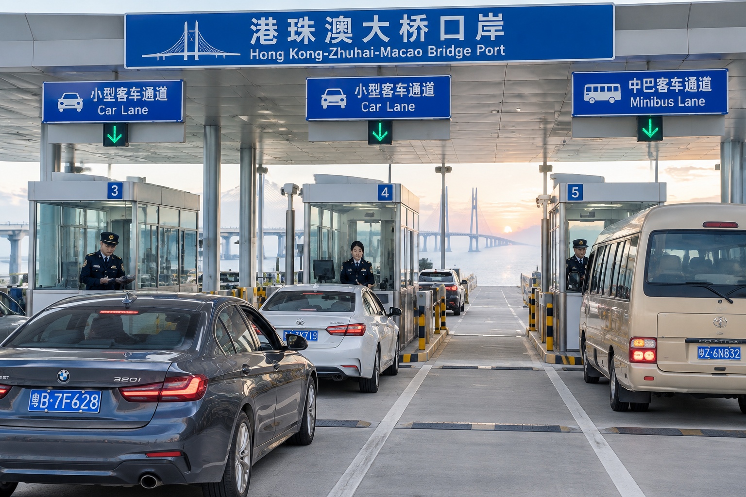
Roughly speaking, the route breaks down like this: about 22.9 kilometers of bridge, a 6.7-kilometer undersea tunnel, two artificial islands where the bridge meets the tunnel, a link road on the Hong Kong side and two border facilities at either end. Vehicles cross three jurisdictions, three currencies and three sets of customs rules in under an hour.
Why the hard part was not building a bridge
Two constraints shaped the whole project, and neither of them had much to do with water depth.
The first was aircraft. The Hong Kong end of the crossing sits directly under the approach paths of Hong Kong International Airport, one of the world’s busiest cargo hubs. A conventional suspension bridge with 200-meter towers would have put steel and cables into airspace that aircraft need.
The second was ships. The estuary is a working shipping channel serving the ports of Guangzhou, Shenzhen and Zhuhai. Vessels of up to 300,000 deadweight tonnes need to pass.
Aircraft want the bridge low. Ships want it high. The answer was to make it low in the middle and go underneath — hence the tunnel, and hence the two artificial islands that exist mainly to get the road from bridge level down into the seabed.
The tunnel was assembled from 33 immersed tube elements, each about 180 meters long and weighing around 80,000 tonnes, the largest and heaviest of their kind in the world at the time. Each element was floated out, lowered into a dredged trench and joined to the previous one with millimeter tolerances by engineers working underwater. The final joint closed in 2017.
The islands were built faster than most engineers expected. Crews drove 120 huge steel cylinders, each 22 meters in diameter, into the seabed to form a watertight ring, then pumped out the water and filled the space inside. It took 221 days for the west island, far quicker than traditional reclamation, and far less disruptive to the seabed. Each island covers about 100,000 square meters — roughly fourteen football pitches.
Other problems were less glamorous but just as real. The route passes near a nature reserve for Chinese white dolphins, so construction schedules were adjusted around the breeding season. The bridge had to be designed for magnitude-8 earthquakes and for typhoons strong enough to close a city. Typhoon Mangkhut hit the region in September 2018, five weeks before opening, and the completed structure rode it out. Salt water corrodes steel and concrete relentlessly, which is part of why the design life is 120 years rather than the usual 50 to 100.
Crossing it: what it takes, what it costs, how long
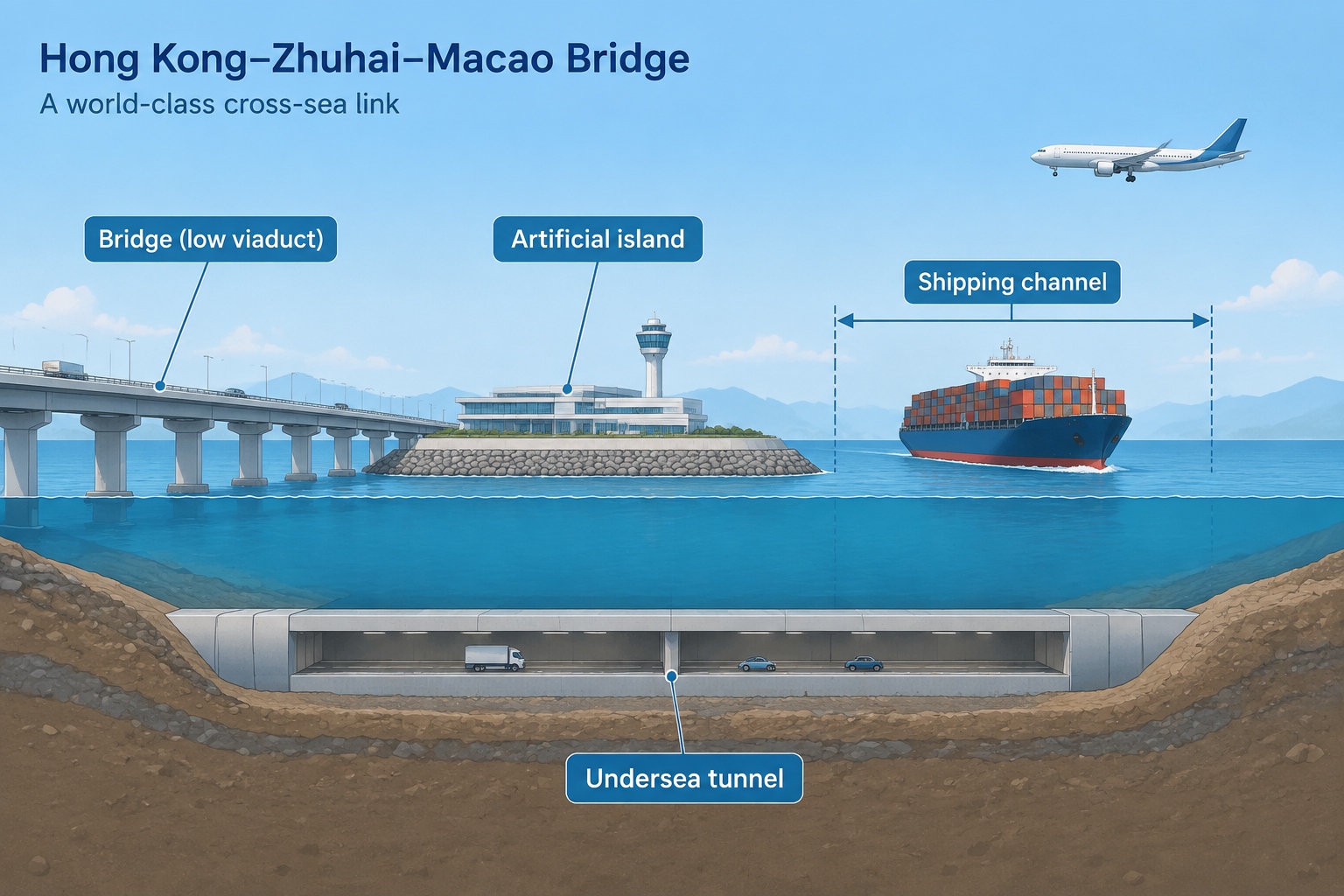
The bridge port stays open 24 hours a day, which makes it the only round-the-clock land crossing between Hong Kong and the mainland. That detail matters more than it sounds. It means a late flight into Hong Kong, or an early meeting in Zhuhai, can be handled by road.
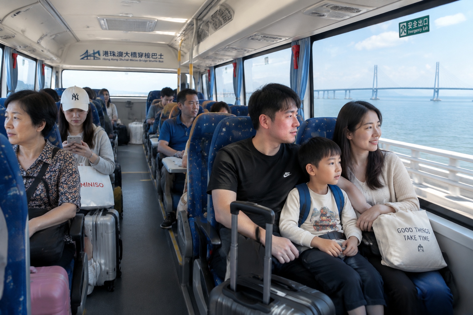
Most people cross on the shuttle bus, known locally as the Golden Bus, which runs every few minutes at busy times and through the night. A daytime one-way ticket costs around HK$65 to HK$70, about US$8 to US$9, with a slightly higher fare at night. The ride across the water takes roughly 40 minutes; add immigration on both sides and the door-to-door trip is usually a little over an hour. Cross-boundary coaches connect the same port to Hong Kong International Airport and major city districts.
Driving your own car is possible, but not casual. Private cars need a cross-boundary permit, a quota allocated by the two governments, valid insurance for both sides and, in most cases, two sets of plates. The toll is 150 yuan — about US$21 — for a single crossing. One small detail tells you a lot: Hong Kong traffic drives on the left, while mainland China and Macao drive on the right, so at the port drivers physically swap sides of the road. The bridge’s main span uses right-hand traffic.
Since 2023 the rules have loosened. A scheme allowing Macao-registered cars to drive into Guangdong began in January of that year, and Hong Kong’s version, known as Northbound Travel for Hong Kong Vehicles, started on 1 July 2023. Tens of thousands of Hong Kong cars have been approved under it, and on holiday weekends the car lanes at the Hong Kong port can back up for well over an hour.
What it changed for ordinary people
The clearest effect is time. The drive from Zhuhai to the Hong Kong port now takes about 45 minutes, against roughly three hours around the estuary before. For a family in Zhuhai, Hong Kong airport became a realistic departure point. For a Hong Kong household, a weekend hotel in Zhuhai — cheaper, roomier, facing the sea — stopped being an expedition.
You can see the pattern in who uses it. Retirees crossing on weekday mornings with empty shopping trolleys and coming back with groceries. University students who study in Hong Kong and go home to Zhuhai on Friday nights. Engineers and sales staff who work for companies with offices on both sides. Parents visiting children who moved across the border for work. Parents-in-law visiting grandchildren. Macao residents heading north for cheaper meals and medical appointments; mainland families heading south for a day in Macao’s old town.
Passenger numbers reflect that shift. Official figures from the bridge port show more than 27 million passenger crossings and about 5.5 million vehicle crossings in 2024, both annual records and roughly 70 percent higher than the year before. The bridge has become a commuter and weekend route far more than the grand industrial artery that early planners sketched.
The regional picture — and where it is still slow
The bridge is one piece of a much larger idea, the Greater Bay Area: eleven cities including Hong Kong, Macao, Guangzhou, Shenzhen, Zhuhai and Dongguan, home to around 86 million people and an economy of roughly US$1.9 trillion. The plan assumes that people, goods and money move between these cities almost as freely as within one city.
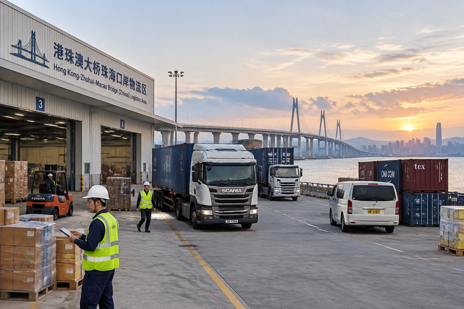
On the freight side, the bridge has helped with what moves fast and light: cross-border e-commerce parcels, fresh food, high-value electronics, and cargo that uses Hong Kong International Airport as a gateway into mainland supply chains. Zhuhai has gained warehouse and logistics space around the port.
But heavy container traffic still overwhelmingly goes by sea, where ships carry thousands of boxes at a time for a fraction of the cost. Freight volumes on the bridge have grown more slowly than passenger volumes, and slower than some early forecasts assumed. The honest version of the story is that the bridge solved a people problem first and a cargo problem second. It also proved that infrastructure alone does not integrate three places — the paperwork has to move too.
Three things people get wrong about it
1. It is not one bridge you can see all the way across
Roughly 6.7 kilometers of the route is under the water, and the bridge also disappears into the artificial islands at both ends of the tunnel. Photographs taken from a drone or a plane give a misleading impression of continuity. From the driver’s seat, the crossing is a sequence: bridge, island, tunnel, island, bridge.
2. You cannot simply turn up and drive it
Without a cross-boundary permit and quota, a private car cannot cross. Most travelers use the shuttle bus or a coach. Even with the newer Northbound schemes, drivers apply in advance, insure their cars for both jurisdictions and obey a quota.
3. It did not replace trains and ferries
The high-speed rail link from Hong Kong’s West Kowloon station to Zhuhai takes a little over an hour, and ferries still connect Hong Kong with Macao and Zhuhai several times an hour. The bridge competes with them on convenience, not on price or speed alone. It won a specific niche: door-to-door journeys, luggage, families, and travel at hours when nothing else runs.
What the queue at the port tells you
Stand at the Hong Kong port on a Sunday evening and the bridge stops being an engineering story. Cars idle in long lines, families unload suitcases from the boot, a bus pulls out every few minutes. Twenty years ago this was open water.
The next things worth watching are unglamorous: how many cross-boundary permits each side releases, whether the planned pilot allowing a limited number of Guangdong cars to drive south into Hong Kong expands, and whether customs procedures for small cargo get simpler. A 55-kilometer sea crossing is finished. Making three systems feel like one road is the part still under construction.
Start the discussion at forum.chinacomes.com