

A tower that was quietly falling apart
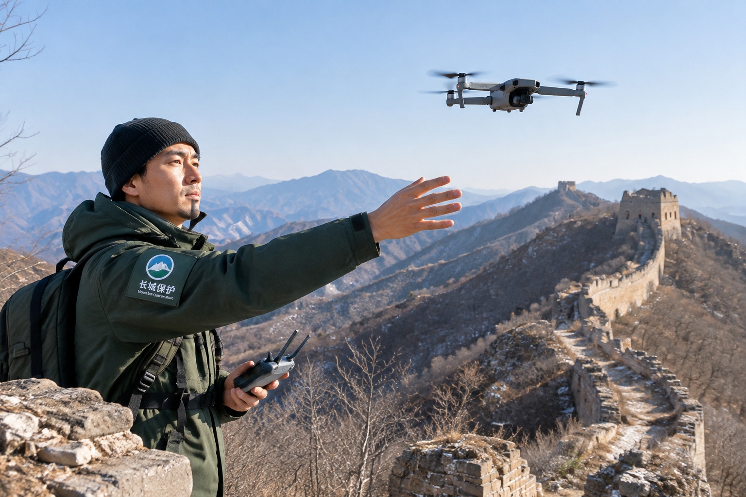
On a cold morning in the mountains northeast of Beijing, a conservation worker named Zhang stands on a ridge and launches a drone the size of a dinner plate. Below him runs a stretch of the Great Wall most tourists never see: no cable cars, no souvenir stalls, just raw stone and brick slowly losing its fight with weather and time.
The tower he is watching looks fine from a distance. Up close, the story is different. One corner has bulged outward by a few centimeters, a sign that water has seeped into the core and frozen and thawed through hundreds of winters. From the ground, nobody would notice until the day a section simply gave way.
This is the quiet crisis of the Great Wall. The parts people visit, like Badaling or Mutianyu, are heavily restored and well guarded. But most of the Wall is not that. According to a national survey completed in 2012, the Ming-era walls alone stretch about 8,850 kilometers, and the full system across all dynasties totals more than 21,000 kilometers. A large share of it is unrestored, remote, and eroding.

Why the Great Wall is so hard to protect
For readers outside China, it helps to drop one common image: the Great Wall is not a single clean line of grey stone marching across postcard mountains. It is a sprawling network of walls, watchtowers, beacon platforms, and forts, built and rebuilt over roughly two thousand years by different dynasties using whatever materials were nearby. In the west, long sections are rammed earth that look more like dunes than fortifications. In the north, they are brick and stone clinging to steep ridges.
That variety is exactly what makes conservation hard. Earthen walls dissolve in rain. Brick sections crack as tree roots push in. Earthquakes shift foundations. And because so much of the Wall sits on terrain too steep or remote for easy access, teams historically could only inspect short segments on foot, often once every few years. By the time a problem was visible to the naked eye, it was usually too late to prevent it cheaply.
What the drones actually do
The new method starts with flying. Teams send drones to photograph a wall segment from dozens or hundreds of angles, then stitch those images into a precise three-dimensional model. This technique, called photogrammetry, turns ordinary photos into measurable geometry. On top of that, some teams mount LiDAR sensors, which fire laser pulses and measure how long they take to bounce back, building a point cloud accurate to within a few centimeters even where vegetation hides the surface.
The result is a digital twin of the Wall. Conservators can rotate it, zoom in on a single brick, and measure the exact angle of a leaning parapet. More importantly, they can fly the same segment again months later and compare the two models. A crack that widened by half a centimeter, a wall that tilted a degree further, a drainage channel that silted up, all of it shows up in the data long before a human eye could catch it on a windy ridge.

In 2019, a project on a steep section of the Jiankou wall northwest of Beijing used drones to generate a full 3D survey before restoration began. The models let planners decide exactly which bricks to stabilize and which to leave, so the repair kept the Wall’s rough, un-manicured character instead of turning it into something new. That mattered to heritage specialists, who increasingly argue that over-restoration erases history as surely as collapse does.
Old hands and new tools
The interesting part is not the gadgets. It is the mix of people now standing on the same ridge. On one side are heritage workers, often locals who have patched these walls by hand for years and know which stones come from which era. On the other are younger technicians who grew up with software and flight controllers but could not tell a Ming brick from a modern copy.
Neither group can do the job alone. The drone operators capture data no human could gather, but the veterans read it. A sudden gap in a model might be real damage, or it might be a shadow, a bird, or a patch of grass. Deciding which requires someone who has touched the wall. In practice, the two sides have learned to argue productively, and the fieldwork has become a conversation between a laser scanner and a lifetime of hands-on memory.
This blend is spreading. Conservation institutes in Hebei, Beijing, and Gansu provinces have all run drone-based surveys, and universities now train students specifically in heritage digitization. The tools are also getting cheaper. A survey-grade drone that cost a fortune a decade ago is now within reach of a provincial cultural relics bureau, which is why the practice is moving from showcase projects to routine inspection.
Catching damage before it spreads
Early detection is where the method proves its worth. On monitored segments, teams have flagged bulging walls, loosening battlements, and blocked drainage channels while repairs were still small and affordable. One recurring finding is water: again and again, the models show that the real enemy is not dramatic collapse but slow saturation, where rain pools where it should drain and quietly rots the core from inside.
Spotting that pattern changes the work. Instead of waiting to rebuild a fallen tower, teams clear a drainage channel or reset a few capstones, a far smaller job. It is the preservation equivalent of fixing a leak before the ceiling falls in. The savings are not just money; a Wall repaired in small, timely steps keeps more of its original fabric, which is the whole point.

What this says about a bigger balancing act
China is often described from the outside through a single lens: fast growth, new highways, cities rising overnight. The Great Wall projects show a quieter counter-current. The same country pouring resources into high-speed rail and solar farms is also sending drones up remote ridges to keep a two-thousand-year-old wall from washing away.
It is a reminder that development and heritage are not always a tug-of-war. The drones, the LiDAR, and the 3D models are the same technologies used to map construction sites and plan infrastructure. Here they are pointed backward, at history, in the service of keeping it standing. For a country sometimes caricatured as bulldozing its past to build its future, this is the more complicated and more honest picture: a conservation worker on a cold ridge, launching a small aircraft to find the cracks no one else can see.
Start the discussion at forum.chinacomes.com