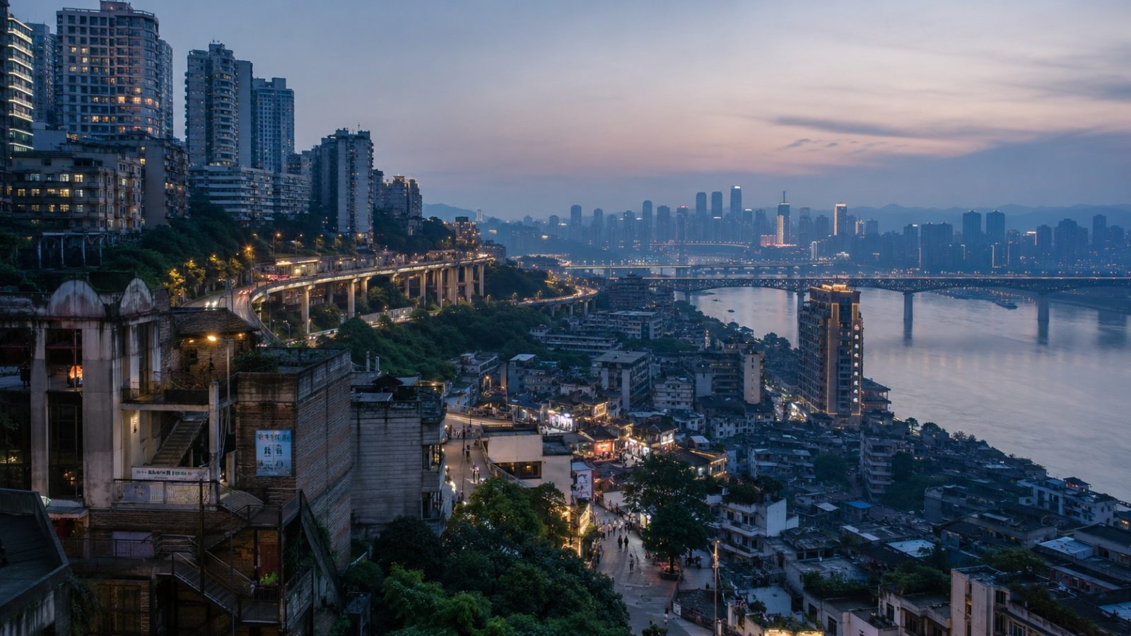
When GPS Fails: A Vertical City in Three Dimensions
You know that specific frustration when your phone insists you have arrived at a destination, but you are actually standing on a pedestrian overpass overlooking a highway three levels below? I experienced this repeatedly during my first week in Chongqing. The map app flashed “you are here,” yet the actual street level was buried somewhere beneath my feet. Navigating China’s most famous mountain city quickly turns out to be less about following lines on a screen and more about learning to read space vertically. What looks like a single intersection from above is often three separate roads stacked at different elevations. This geographic reality has shaped how millions of people live, work, and move through the urban landscape every day.
Vertical Streets and Human Navigation Logic
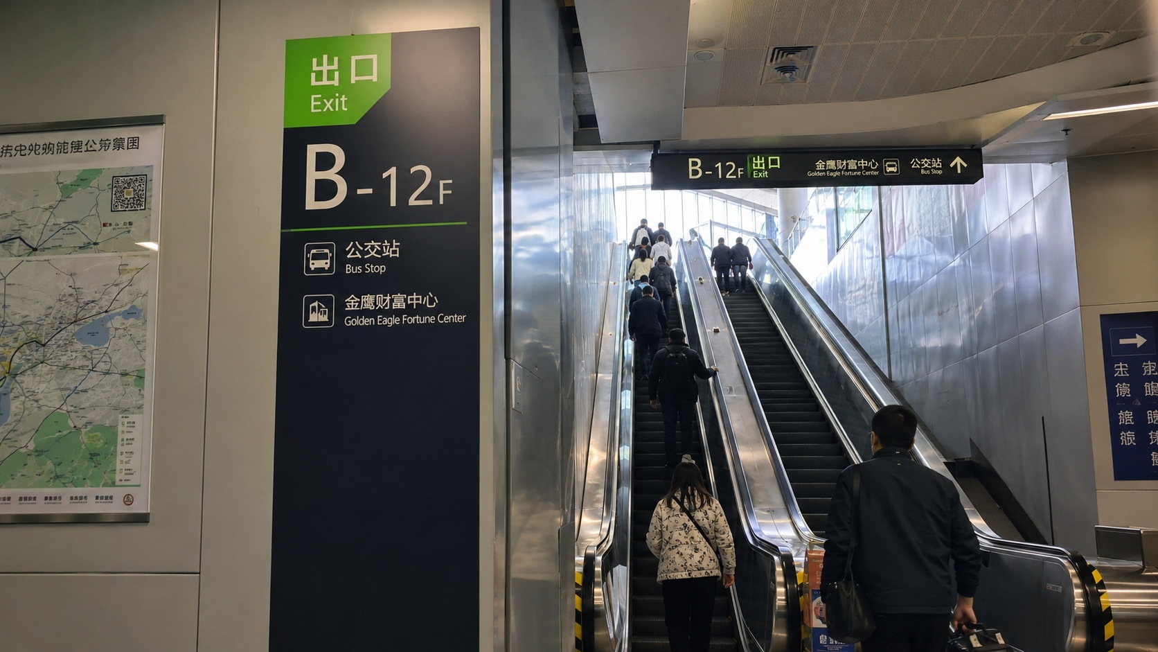
Flat-grid cities teach us to navigate with left turns, right turns, and distance markers. Chongqing operates on a completely different logic. Built between two major rivers and wrapped in hills, the city stacks its infrastructure like layers of sedimentary rock. Locals do not rely on street names alone. They navigate by elevation and visual anchors. A typical subway exit sign will not just say “Exit B”; it will specify “Exit B – 12F, connects to shopping mall lobby.” This vertical wayfinding is not a tourist gimmick or an architectural novelty. It is a practical response to terrain that has dictated urban planning for decades.
When you ask a local for directions, they rarely give you distances in meters or minutes. They tell you: “Go up until you see the yellow water tower, then turn left on the third floor.” This cognitive shift from horizontal to vertical navigation is the first lesson any visitor must absorb. You learn that distance here is measured in stairs, ramps, and elevation changes rather than straight-line kilometers. The city rewards patience over speed, and observation over blind screen-gazing.
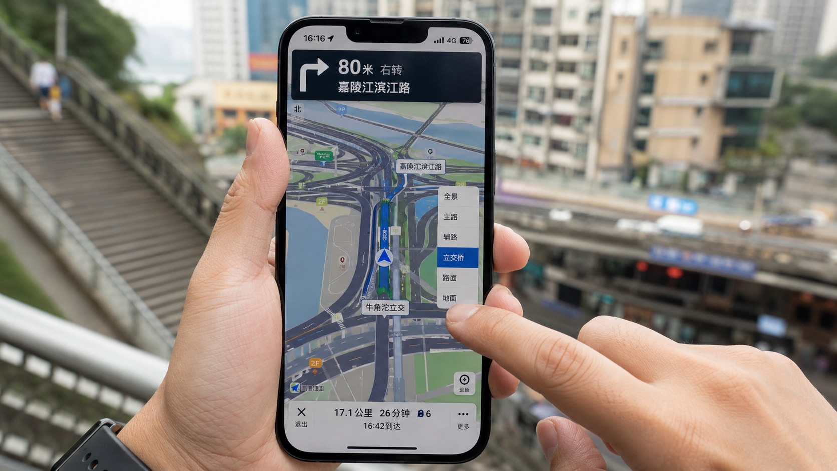
The Digital Layer Over a Mountainous Grid
If topography breaks traditional mapping, China’s digital infrastructure patches the gap seamlessly. In Chongqing, navigation apps do not just draw routes; they render three-dimensional layers that account for bridges, overpasses, interchanges, and hidden staircases. During my daily routine, I watched delivery riders switch between map views to find the fastest way through a maze of interconnected walkways. The technology is not replacing human intuition; it is amplifying it.
WeChat mini-programs now handle everything from subway route planning to real-time bus tracking, all tailored to dense urban layouts and seasonal weather shifts. For visitors, downloading a local map application and learning to toggle between standard 2D views and vertical layer modes is the single most practical step you can take before stepping outside. The digital navigation system has become as essential as the concrete below it, transforming what once required memorization into a tap-and-go experience.
Rhythm, Community, and the Space Between Steep Slopes
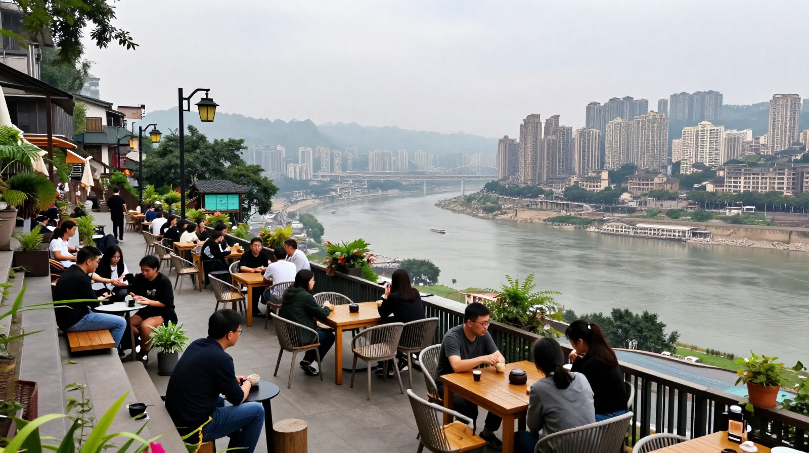
Beneath the tech and the steep inclines lies a slower, deeply human rhythm. Climbing hills is not just exercise; it is how neighborhoods connect. Tucked behind commercial plazas or along winding service roads, you will find old residential alleys where neighbors still gather over steaming bamboo baskets of dumplings. Young professionals who work in glass towers during the day often escape to hillside cafes with terraces that overlook misty river bends. These spaces do not feel curated for social media engagement; they feel lived-in.
The pace here is not dictated by traffic lights or grid blocks, but by the natural flow of elevation and community habit. You learn to stop rushing down straight corridors and start noticing how light falls on a stairwell at four in the afternoon, or where the best spot is to wait out a sudden mountain shower. Asking for help feels less like an inconvenience and more like a shared local practice. Strangers will often walk you part of the way, pointing out landmarks rather than giving abstract directions. This mutual aid habit stems from terrain that makes isolation difficult and collaboration necessary.
From Getting Lost to Reading the City
After three days of misreading floor numbers, taking express elevators that opened into mid-air parking garages, and finally trusting a stranger’s hand gestures over my screen, I stopped trying to conquer Chongqing with GPS. Instead, I started reading it like a local: by height, by texture, by the way people naturally cluster around shaded ramps and open plazas. This city does not reward rigid navigation habits. It asks you to adjust your perspective.
For anyone planning a cross-cultural trip or simply curious about how modern Chinese urban life actually functions on the ground, Chongqing offers a masterclass in adaptation. The roads are steep, the signals change with elevation, and the map is constantly being redrawn by foot traffic and new construction. But once you stop fighting the terrain and start moving with it, the city stops feeling like a puzzle. It becomes simply where you are.