When the Arrow Spins: Standing Still at Three Street Levels
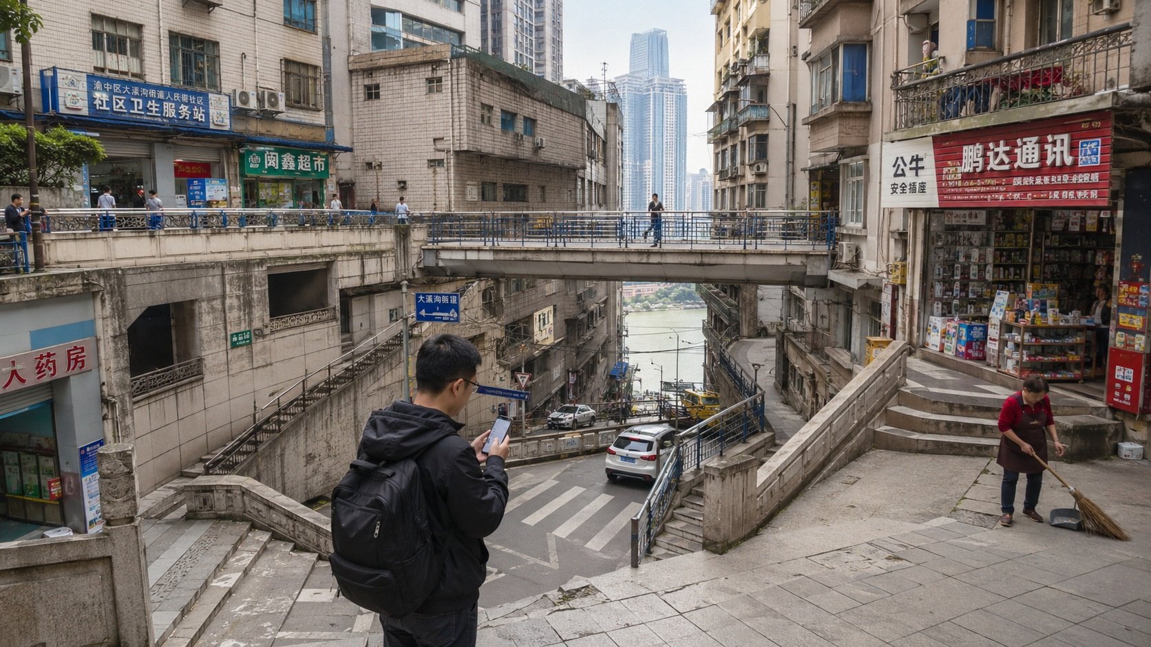
I stepped out of the subway exit in Yuzhong District and immediately checked my phone. The navigation app placed a blue dot exactly where I stood, but the arrow kept rotating like a compass losing its north. In front of me, a noodle shop sat on a lower ramp; behind it, a commercial plaza perched at street level; above that, another row of shops clung to a higher ridge. All three shared the same address line. A vendor sweeping the sidewalk looked up from his broom. When I asked how to reach Lianglukou, he didn’t pull out a map. He pointed down, then tilted his chin upward, and said, “Walk past the blue door, take the concrete stairs behind it, turn left at the yellow wall, and you’ll hit the second street.” It took twelve minutes. Two-dimensional GPS couldn’t track it. Three-dimensional logic worked instantly.
Rethinking “Up” and “Down” in a Layered City
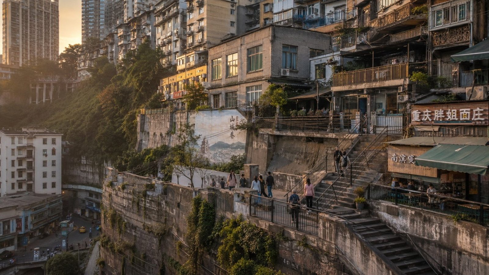
Chongqing’s vertical transportation system forces residents to abandon traditional elevation cues. Locals rarely say “go up to the third floor.” They describe routes using horizontal markers: “cross the bridge, walk until you see the red signboard, enter the alley on your right.” Street signs often list multiple names for what appears to be a single road, depending on which hillside level you’re standing on. Building floors follow the same pattern. A ground-floor lobby might open onto a ramp that drops forty meters below the actual street traffic above. Elevators in older residential blocks frequently skip numbers or reset counts at different elevations. The mental map shifts from altitude to sequence. You don’t measure distance in meters; you count landmarks, turns, and level changes.
The Human Algorithm: Filling the GPS Gap
When digital navigation fails, analog memory takes over. Didi drivers in Chongqing carry what locals call a “vertical atlas” in their heads. They know which tunnels collapse signal strength, where overpasses merge at staggered heights, and which alleys shortcut between districts. Neighborhood WeChat groups operate as real-time traffic sensors. Messages like “the elevator at Block 4 is under maintenance—use the side stairs,” or “rain has flooded the lower ramp near the market,” spread faster than official transit alerts. Young professionals who rely on apps don’t trust a single source. It’s common to see commuters running two navigation programs simultaneously, cross-checking routes when one app insists a dead-end path leads forward. The city doesn’t reject technology; it layers human verification over it.
Commuter Infrastructure, Not Theme Park Attractions
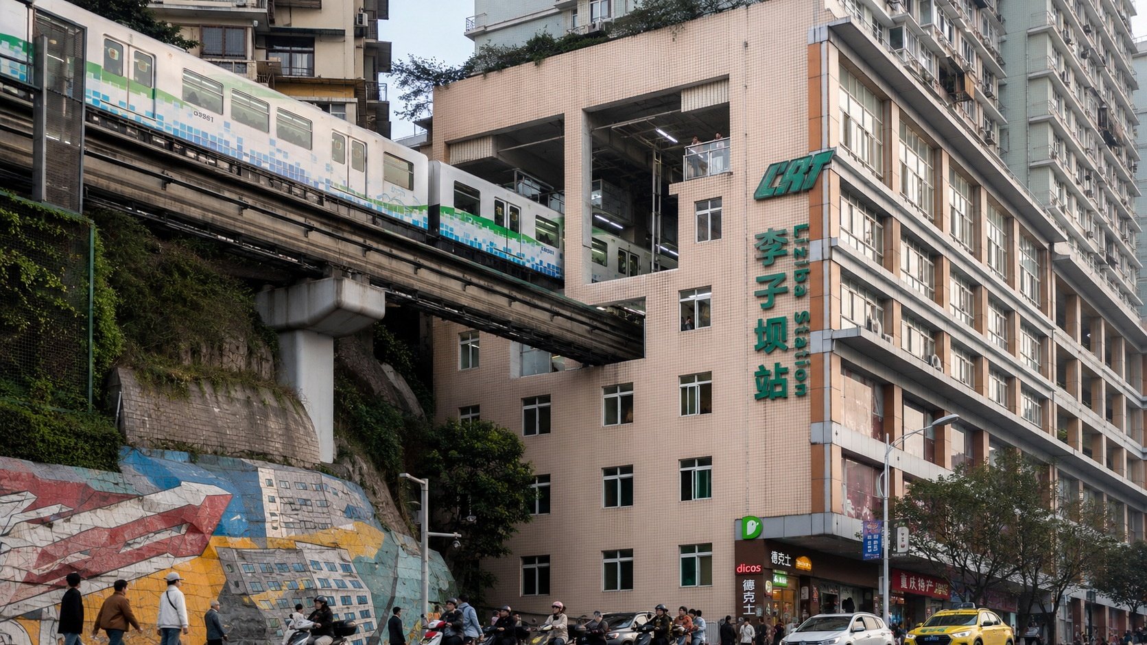
The famous monorail that slices through a residential building at Liziba draws tourists with camera tripods, but for locals it’s just the morning commute. The fare matches standard public transit pricing—between two and six yuan depending on distance. Residents board during rush hour alongside students carrying backpacks and workers in reflective vests. Windows face directly onto the tracks; many households have lived with the low hum of passing trains beneath their floors for decades. Skywalks, elevated corridors, and cable cars connect districts without forcing long detours down steep slopes. These aren’t architectural gimmicks designed for social media. They are practical solutions to polycentric urban life, stitching together neighborhoods that geography otherwise isolates.
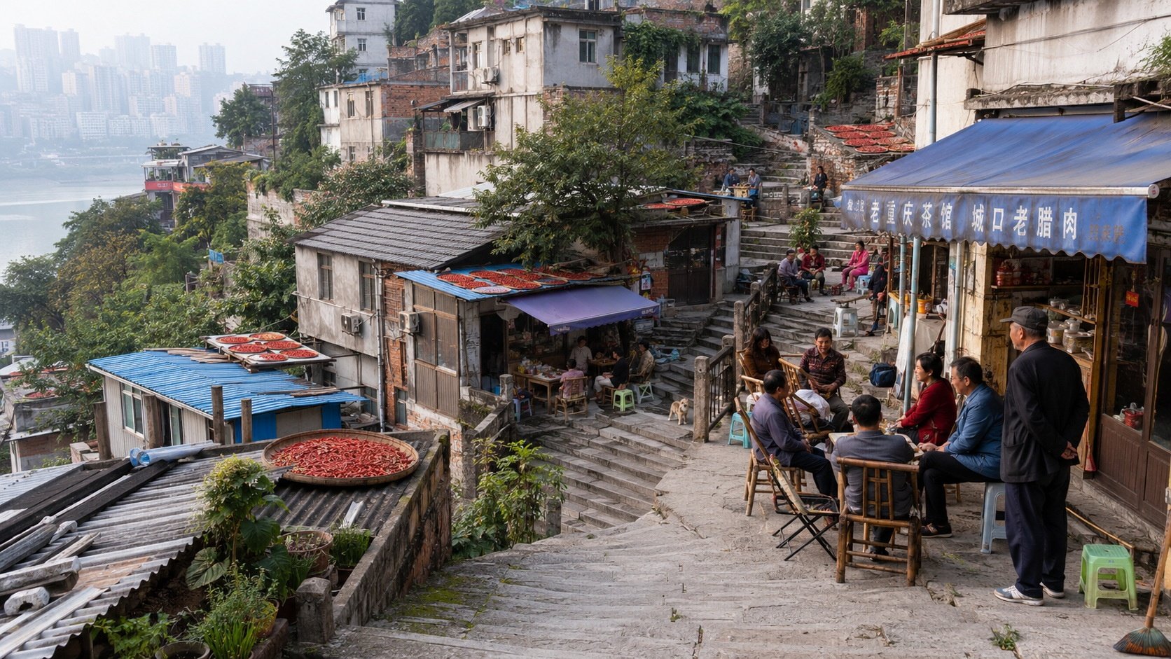
Staircases as Social Grids
Vertical terrain doesn’t just reshape routes; it structures daily interaction. Concrete staircases cut through old residential blocks double as informal social corridors. At half-mountain slopes, small teahouses open along the steps, offering cheap tea and folding chairs for neighbors who pause to chat or watch children play below. Rooftops on older walk-ups aren’t abandoned storage spaces. Many are converted into vegetable plots where residents grow chili peppers, bok choy, and herbs. Urban renewal projects in these areas focus less on demolition and more on micro-upgrades: installing handrails along slippery steps, adding drainage channels to prevent pooling after rain, and retrofitting elevators into buildings that once required climbing dozens of stairs. The city adapts around the hillside rather than flattening it.
Folding Into the Mountain
Chongqing’s geography isn’t a puzzle to solve; it’s a rhythm to learn. What outsiders label “magic” or “eight-dimensional” is, in practice, a set of repeated movements that become automatic. The confusion of overlapping levels fades after months of walking the same routes. Navigation apps improve their maps as drivers and pedestrians upload corrected coordinates. Transit lines extend into previously unreachable slopes, turning former detours into direct links. For international readers familiar with grid-based cities, Chongqing offers a different model of urban resilience. It doesn’t conquer difficult terrain; it folds into it, building infrastructure that moves vertically alongside horizontal streets. The result is a city where ordinary life continues without waiting for perfect maps.